Fair warning: this is gonna be a quite extended post; its contents will eventually include a kinda all-encompassing account of ONE TRIP we took to the Clark Fork River valley (and its tributaries) and Missoula. It will take me several days to get through all we did there. SO: if you are one of my readers who visit every day, keep looking at this one, because you will most certainly miss something if you only view it once...
Toward the end of May, we set our (ever-restless) sights on western Montana and the Missoula area. I had stumbled upon a geological phenomena I wanted to witness for myself (Google is the best thing EVER) out there, and the Clark Fork River and its surroundings are one of the 'must-sees' that all the Montana natives recommend.
For geological background, and before you proceed, you should go to this site:
http://www.glaciallakemissoula.org/story.html
and read about what most geologists (the secular ones, anyway) now concede constituted the largest flood catastrophe in Earth's history. It left its mark on the entire northwest section of what is now the continental United States, was unthinkably violent and, perhaps coolest of all according to current anthropological theory, was probably actually witnessed by the earliest Native Americans. After studying this event, this author decides that he would have cheerfully bartered any number of pretty important body parts in exchange for a front-row seat to the party... And, over about 2,000 years, it happened FORTY-TWO TIMES!
Anyway, that's only a small part of what we saw and did in the area. Like I said, I'm gonna (try to) just give you the photos and the captions and let you interpret as you will. If I see something that needs further narration, I'll just insert it by the pic.
Artist's Rendering Of The Missoula Area With Glacial Lake Full:
Another Geologist's Concept:
Missoula Valley Pic We Took From 'M' Mountain, For Comparison:
Go here for a Virtual Tour of the effects and scale of this astounding event:
http://www.glaciallakemissoula.org/virtualtour/
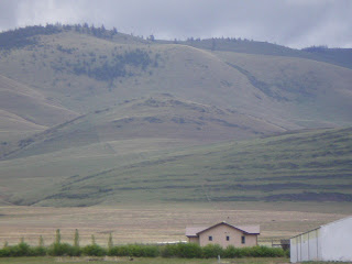
We also drove out to a place called the Camas Prairie, where you can still see 'ripples' and 'scours'. These were areas where the water drained so quickly that it left clues that first led geologists to the truth about this thing. Here are some pictures of that. Remember, looking at the images you can't even IMAGINE the scale of what happened here...
The Following 4 Pics Contain 'Scouring' And 'Ripples'. See If You Can Spot Them:
Hungry now. Be back later today with hypothermia-in-whitewater and The Ghost Rails Inn (and the Clark Fork at flood and blah blah blah lots more)...
OK, I'm back in the saddle. As usual, 'later today' means 'tomorrow' but never mind that now...
The Blackfoot River will be familiar, by sight if not by name, to anyone who's ever seen the movie 'A River Runs Through It'. It stars Robert Redford and Brad Pitt, among others, and is and based upon a short novel by a guy named Norman MacLean. The film's (and the book's) closing line goes something like this:
"Eventually, all things merge into one, and a river runs through it. The river was cut by the world's great flood and runs over rocks from the basement of time. On some of the rocks are timeless raindrops. Under the rocks are the words, and some of the words are theirs. I am haunted by the waters."
Serious challenge is involved in chronicling an adventure such as the one in which we find ourselves immersed (Q:"How did we GET here?" A:"I LED you here, my son, for I am Spartacus"): attempting to describe the magic, joy and overwhelming sense of wonder that often threatens to burst our hearts; to GIVE you what it's like, without becoming, in the process, putridly maudlin or tearfully (GAY-ly) sentimental. In that endeavor, as any of my consistent readers will testify, this author consistently fails miserably. Sorry.
We hired a company called 10,000 Waves (www.10000-waves.com) to take us rafting. It's owned and run by a very nice man-and-wife team, Kienan and Jeanette Slate. These folks are hard-core professionals, stringently licensed and regulated by the State of Montana, and as it was still the middle of May (and all the rivers here flood like hell in spring), they were understandably concerned about safety. Our first choice river, the Clark Fork (more about that monster later), was still considered way too high and dangerous, so they agreed to take us down a stretch of the Blackfoot that their calculations indicated was unlikely to whack us out, thereby preserving the spirit of their 'No-Killing-The-Clients' policy.
Like I said, it was early in the year, so we and one other couple had a boat all to ourselves, and Kienan was nice enough to do the honors as guide personally. I think most of his employees are seasonal, students at Montana State in Missoula for example, and were not on the scene that early in the year. So it was really cool to get to go with the company owner. The man knows his stuff... and he REALLLY knows that river.
The 10,000 Waves Shuttle And Our Boat:
NOTE: if anybody is expecting to see here a photo taken going through any really rough water, you might as well just skip it. I can personally testify that during those stretches (and there are LOTS of them) you are WAY too busy to think about hauling out the camera. These guys run a tight ship, and the rafters are required to WORK when the going gets tough. As captain, Kienan wasn't shy about letting us know what was expected to keep us oriented properly and safe, and he has my profound respect accordingly...
Allison Getting Ready; Note Wet Suit, That Water Is COLD:

Us And Shipmates During A Calm Stretch:
Allison The Trooper, Wet Cold And Scared:
Much-Appreciated Hot Chocolate Break:
On The Left Is Kienan Doing His Captain Bligh Impression:
By the way, this area is right where Ted Kaczynski (AKA The UnaBomber) hid out while playing his little explosives-mailing game...
A View By Kaczynski's Cabin, Taken From The Blackfoot:
OK, that's it for the raft trip. I can't describe adequately how much fun it was anyway, and there's (as always) not enough room for all the cool photos, so we're gonna move on now.
While we were in the area, and for about three days, home for us was a very cool B&B called The Ghost Rails Inn:
http://www.ghostrailsinn.com/
It's an old hotel, built in 1909, that used to serve the Milwaukee Railroad line between Chicago and Seattle. It's now owned by Thom Garrett and Grace Doyle; Thom was a science teacher here in Montana in a previous life, and I am indebted to him for both his in-depth knowledge of the Lake Missoula floods and his willingness to talk to me about the subject until (I'm sure) he was heartily sick of it. Grace is a quilter extraordinaire, and has some really fine work both on display and for sale there. They have spared no expense in both redecorating the hotel and making it feel like a personal home (which indeed it is, for them) and both the accomodations and the ambience are innately satisfying. No phones, no TV, no stress... an ideal 'base of operations' when visiting the area. And, they are the ones who turned us on to 10,000 Waves; they actually contacted the rafting company and had all our reservations made, per my request, by the time we arrived! Exquisite service.
The Ghost Rails Logo (I Actually Got Permission For This One):

Exterior Of The Ghost Rails Inn:
Our Room At The Ghost Rails:
Final notes about Ghost Rails: HIGHLY RECOMMENDED; they made the mutts feel as welcome as if they lived there, and the food was nothing short of fantastic. Scrupulously clean, well-run and homey. Thanks, Thom! Thanks, Grace!
The next few pics are from the Bison National Wildlife Refuge. This is a park in the mountains and tundra that rise above the Camas Prairie (mentioned earlier in the Lake Missoula section)
Deciding Whether To Charge The Car:
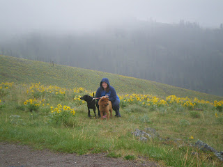
Allison And Dogs On Tundra:
Yes, Places Like This Really Exist:
Scotty On Bison Range Alpine Trail:
Mutant Mule Doe, Gotta Weigh 200 Lbs:
A 'Pleasant Pheasant' (And Your Author Is Losing His Mind):
Last, but not least, some miscellaneous pictures from the rest of our stay, with brief (for me, anyway, darned motormouth, what happened to hyperdrive?) captions...
Sitting On The Clark Fork At Flood; NOISY!
A Redundancy At Fish Creek, Lolo National Forest:
The Clark Fork River From Natural Pier:
Missoula And U of M From Insanely Steep Trail Above College:
Montana Grizzly Stadium From Same Insanely Steep Trail:
Quite By Accident, The Tallest Pine In MT, Lolo Nat'l Forest:
(Inevitable query: how do they know that? Did this tree return a Census form? If so, how does the tree get the form to the post office? Does the Park Service have one guy that just wanders the forest with a surveyor's sextant measuring trees? Or does this tree's mother maybe have, somewhere, a titanic door jamb upon which she (?) scrupulously inscribes with a giant Sharpie Junior's annual growth record? And then brags about it at the Conifer Mothers' Annual Tea And Brunch?)
And finally,
McDonald Pass Blizzard, On Way Back From Missoula, May 23rd:
(Note to self and others: does it EVER stop snowing here? The answer, apparently, is no. See what I mean in the next post.)
If you are paying attention, and if you read the previous captions and notes, you will be painfully aware that Your Author is tired enough that weird things are happening inside his head. SO: this post is done.
Next up: The Butte And Georgetown June Snowstorm. We Backpack Into Bear Country. Yellowstone Park. The Beartooth All-American Road. And much, much more.
Friday, June 27, 2008
Glacial Lake. We Ride The Blackfoot. Ghost Rails.
Subscribe to:
Post Comments (Atom)


No comments:
Post a Comment